
Skip to product information

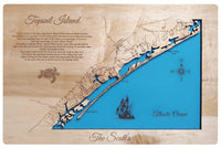

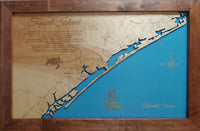


This is a beautiful, detailed, laser engraved and precision cut map, including lake information such as surface area, elevation and maximum depth.
Included With All Maps:
- Points of interest laser engraved into the map face
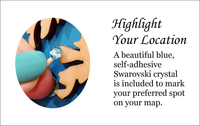
- A blue, self-adhesive Swarovski crystal to mark your preferred location on the map
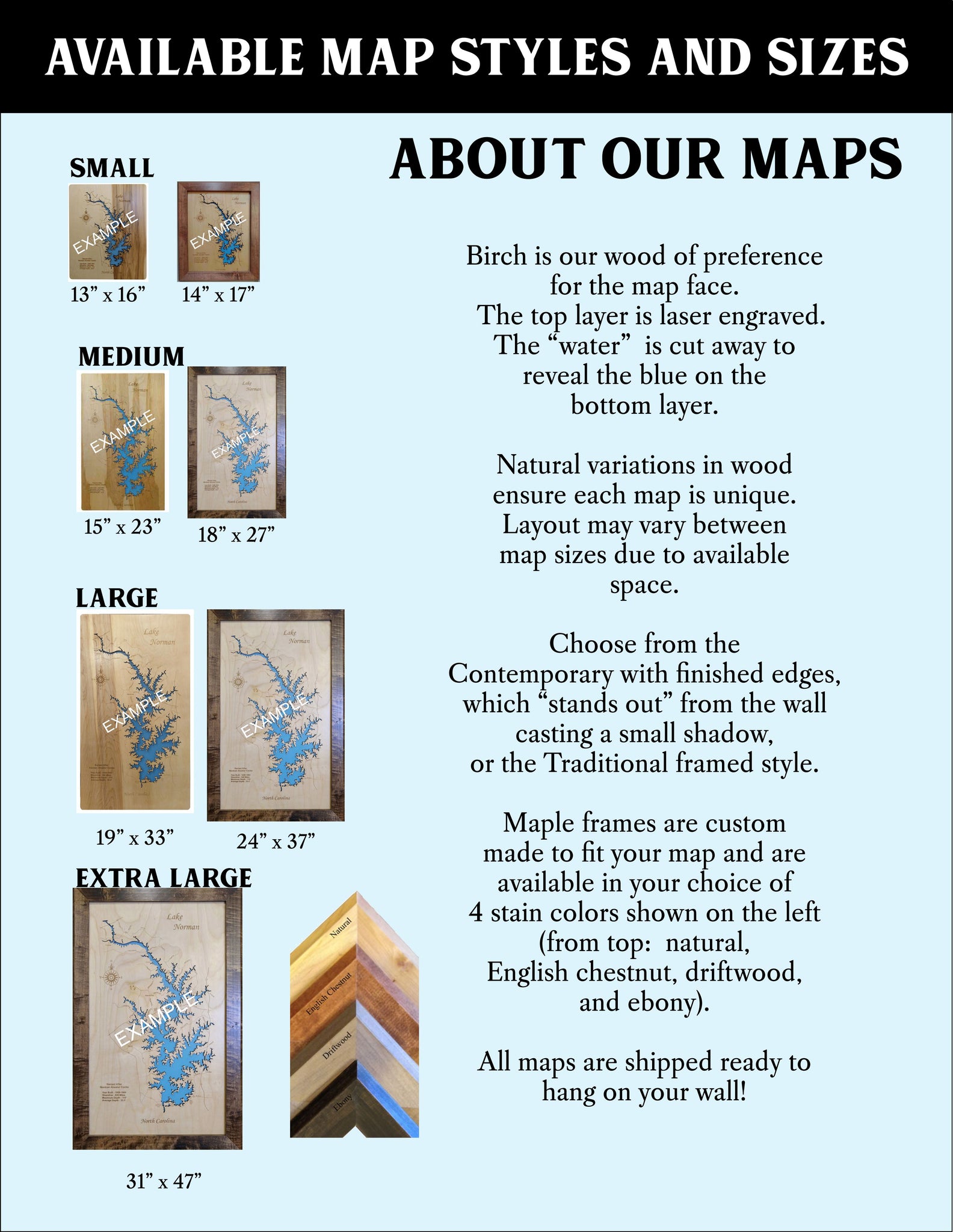
Our maps are made from beautiful birch plywood. Natural variances in the wood grain ensure a unique work of art. Once the map is cut, it is hand sanded multiple times, mounted on a blue board to highlight the water, and given a clear coat for a lustrous wood shine. Proudly made in the USA by American workers in an American owned business.
Custom Engraving Available
Add up to 2 lines of custom engraving at no additional cost!
Standard Engraving:
- Topsail Island is a 26-mile long barrier island off the coast of North Carolina.
- Topsail Island is a sanctuary for sea turtles and is also known for its beautiful beaches. There are only two ways on and off the island: a swingbridge in Surf City, and high rise bridge in North Topsail Beach.
- According to popular belief, Topsail Island got its name when pirates used to hide in the channel between the island and the mainland waiting for merchant ships loaded with goods to pass. The pirates would attack the ships and claim the cargo as their own. Eventually the merchants became aware of the hiding place and began looking for the topsail, which was supposedly the only part of the pirate ship that could be seen by the passing victim.